Downloads
DOI:
https://doi.org/10.7480/rius.4.795Abstract
Geodesign provides a conceptual framework through which to understand relationships between geoscience and design. This paper takes its point of departure from the merger of the Departments of Geography and Geology and Forest, Landscape and Planning at the University of Copenhagen, and the subsequent approach taken to Geodesign as a means to realise potentials within the new academic structure. The aim is to address specifically how an on-going process of transforming the Landscape Architecture program has begun to integrate GIScience in a new way that fosters integration within and between disciplines. The approach to Geodesign will therefore be discussed in terms of cross-disciplinary dialogue and curriculum development. Emphasis will be placed on the results of the Geodesign Conference held at UCPH in November 2014 at which practitioners and academics came together to present extensive experiences and understandings of Geodesign. The conference was also the forum for discussion of the challenges and opportunities offered by Geodesign in the context of teaching.
How to Cite
Published
Issue
Section
License
Copyright (c) 2016 Aleksander Andrzej Stysiak, Søren Zebitz Nielsen, Richard Hare, Bernhard Snizek, Hans Skov-Petersen

This work is licensed under a Creative Commons Attribution 4.0 International License.
References
Balstrøm, T. (1992). Universitetssamarbejde på GIS-området [GIS collaboration between Universities]. Landinpektøren 2.
Balstrøm, T., Jacobi, O., & Sørensen, E. M. (Eds). (1992). GIS i Danmark [GIS in Denmark]. Teknisk forlag.
Balstrøm, T., Jacobi, O., & Sørensen, E. M. (Eds). (1999). GIS i Danmark 2 [GIS in Denmark 2]. Teknisk forlag.
Batty, M. (1995). Planning support systems and the new logic of computation. Regional development dialog, 16(1), 1-17.
Bruner, J. S. (1960). The Process of Education. Cambridge, MA: Harvard University Press.
Danish Geodata Agency (2014a). General information on the "basic data programme”. Available from http://eng.gst.dk/
Danish Geodata Agency (2014b). Danmarks frie geodata i en Minecraft-verden [Denmarks’ free geodata in a Minecraft World]. Available from http://gst.dk/emner/frie-data/minecraft/
Danish Planning System (2014). Available from www.plansystemet.dk
Danmarks Miljøportal (2015). Available from http://www.miljoeportal.dk/Sider/Forside.aspx
Denmark (2014). Lov om infrastruktur for geografisk information [Law on infrastructure for geographical information]. https://www.retsinformation.dk/Forms/R0710.aspx?id=122571
Ervin, S. M. (2012). Geodesign Futures – Nearly 50 predictions. Speech at DLA 2012 Conference: Geodesign, 3D Modeling, and Visualisation.
Fisher, T. (2010). The What and Why of Geodesign. Speech, Geodesign Summit 2010. Redlands, CA: Esri Press.
Fisher, T. (2014). On the rationale, definition and history of Geodesign. Speech at the Geodesign Conference in Copenhagen.
Geertman, S. & Stillwell, J. (Eds.). (2009). Planning support systems: concepts, issues and trends. In Planning and support systems – best practices and new methods (pp. 1-26). Springer Netherlands.
Geodesign Conference (2014). Geodesign Conference in Copenhagen homepage. Available from http://ign.ku.dk/english/outreach-publications/conferences-seminars/geodesign-conference/
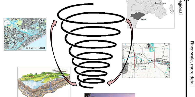
Harden, R. M, Stamper, N. (1999). What is a spiral curriculum? Medical Teacher, 21(2). 141-143.
Historisk atlas (2015). Available from http://historiskatlas.dk/.
IGN, (2013). A strategy for the development of Department of Geosciences and Natural Resource Management, Faculty of Science, UCPH. Available from http://ign.ku.dk/om/organisation/strategi/ign-strategy-2016-eng.pdf
INSPIRE (2014). Infrastructure for spatial information in the European Community. Available from http://inspire.ec.europa.eu/.
Jacobi, O. (2006). 50 år med landmåling, fotogrammetri og digitale geodata. Fra en undervisers univers [50 years of surveying, photogrammetry and digital geodata. From a teacher’s perspective]. Geoforum Perspektiv, 5(10).
Jørgensen, J., Hermansen, B. & Jensen, J. H. (1993). Brugervejledning til ZETA. Miljøministeriets geografiske informationssystem, version 4.0. [ZETA user’s manual. Min. Of Env. Geographical informationsystem. Ver 4.0]. Danmarks Geologiske Undersøgelse, Datadokumentation, 17.
LumenRT (2014). The Communication Platform for Architecture and Geodesign. Available from http://www.lumenrt.com/
Minecraft (2014). Available from https://minecraft.net/.
Paradis, T., Treml, M., & Manone M. (2013). Geodesign meets curriculum design: integrating Geodesign approaches into undergraduate programs, Journal of Urbanism: International Research on Placemaking and Urban Sustainability, 6(3), 274-301. DOI: 10.1080/17549175.2013.788054
Platou, S. W. (1984). The ADK database systems (PADS and LADS) used in Denmark. Soil Information Systems Technology. Proceedings of the sixth meeting of ISSS Working Group on Soil Information Systems, Bolkesjø, Norway. Pudoc Wageningen.
Steinitz, C. (2012). A Framework for Geodesign. Redlands, CA: Esri Press.
Steinitz, C. (2013). Organizing Geodesign for Education. Speech, Geodesign Summit 2013. Available from http://video.esri.com/watch/2200/geodesign-for-education