Downloads
DOI:
https://doi.org/10.7480/rius.4.825Abstract
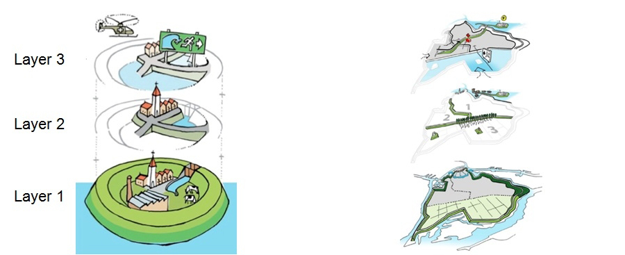
This paper aims to frame the multi-layered water safety concept in the context of a systematic, thorough, multidisciplinary and collaborative methodology for complex problems solving, i.e. geodesign. Multi-layered safety is an integrated flood risk management (FRM) concept based not only on flood probability reduction through prevention (layer 1), but also on consequences’ minimization in the case of a flood through spatial solutions (layer 2) and crisis management (layer 3). It has been introduced in the Netherlands in 2009 following the European Flood Risk Directive adopted in 2007. In this study, the multi-layered safety is qualitatively assessed, demonstrating that it rather resembles a parallel system, and that collaboration is required to decide about the most desirable safety measures, which should not only be based on their economic efficiency but also on their social acceptability. In the light of these factors, we attempt to methodologically systematize the multi-layered safety concept by following the geodesign framework. The latter means that, through its implementation, understanding of the current situation of a particular area of interest, which in turn it may support, the allocation of weights regarding the three layers of the multi-tier safety concept is facilitated. Furthermore, the geodesign of the multi-layered safety shows that participation and interaction of the safety policy makers, as well as iterations for achieving maximum consensus between them concerning the more balanced safety measures, taking into account their economic efficiency, their impact on the environment, the local circumstances and the values of the people at place, are methodologically enabled.
How to Cite
Published
Issue
Section
License
Copyright (c) 2016 Panayiotis Sophronides, John Steenbruggen, Henk Scholten, Maria Giaoutzi

This work is licensed under a Creative Commons Attribution 4.0 International License.
References
ACIR (2005). The Laxity Beyond. Towards an effective multidisciplinary information provision from large-scale joint action in our decentralized unitary state. [In Dutch] De Vrijblijvendheid Voorbij. Op naar een effectieve multidisciplinaire informatievoorziening bij grootschalig gezamenlijk optreden in onze gedecentraliseerde eenheidsstaat. Adviescommissie Coördinatie ICT Rampenbestrijding, Dutch Ministry of Internal Affairs and Kingdom Relations.
Alexander, K. A., Janssen, R., Arciniegas, G., O'Higgins, T. G., Eikelboom, T., & Wilding, T. A. (2012). Interactive marine spatial planning: siting tidal energy arrays around the Mull of Kintyre. PLoS ONE, 7(1), e30031. Available from: doi:10.1371/journal.pone.0030031 (Accessed 18th November 2015).
Arciniegas, G., Janssen, R., & Omtzigt, N. (2011). Map-based multicriteria analysis to support interactive land use allocation. International Journal of Geographical Information Science, 25(12), 1931-1947. Available from: doi:10.1080/13658816.2011.556118 (Accessed 18th November 2015).
Arciniegas. G., Janssen, R., & Rietveld, P. (2013). Effectiveness of collaborative map-based decision support tools: Results of an experiment. Environmental Modelling and Software, 39, 159-175. Available from: doi:10.1016/j.envsoft.2012.02.021 (Accessed 18th November 2015).
Arrow, K. J., Cropper, M., Eads, G., Hahn, R., Lave, L., Noll, R., et al. (1996). Benefit-cost analysis in environmental, health, and safety regulation. USA, American Enterprise Institute, The Annapolis Center and Resources for the Future: AEI Press.
Artz, M. (2010a). Geodesign: New Concept or New Name? Geospatial TODAY, 34-35.
Artz, M. (2010b). Changing Geography by Design: Selected Readings in Geodesign. Esri Press. Available from: http://www.esri.com/library/ebooks/geodesign.pdf (Accessed 10th November 2014).
Bakker, M. H. N., Green, C., Driessen, P., Hegger, D., Delvaux, B., Van Rijswick, M., et al. (2013). Flood Risk Management in Europe: European flood regulation. STAR-FLOOD Consortium, Utrecht, The Netherlands. Report number: 1_D1.1.3_2013_06_11.
Batty, M. (2013). Defining geodesign (= GIS + design?). Environment and Planning B: Planning and Design, 40(1), 1-2. Available from: doi:10.1068/b4001ed (Accessed 16th November 2015).
Brättemark, M. (2010). European Floods Directive and progress in developing flood risk management plans. In: Conference on Flood Risk Management Approaches Worldwide: From Theory to Practice, 30 November-1 December 2010, Washington DC, USA. Available from: http://www.nfrmp.us/ifrma/docs/pre/summary/HormandingerPaper.pdf (Accessed 14th November 2014).
Büchele B., Kreibich H., Kron A., Thieken, A., Ihringer, J., Oberle, P., et al. (2006). Flood-risk mapping: contributions towards an enhanced assessment of extreme events and associated risks. Natural Hazards and Earth System Sciences, 6(4), 485-503. Available from: doi:10.5194/nhess-6-485-2006 (Accessed 9th November 2015).
BZK (2008). National Security, National risk assessment 2008. [In Dutch] Nationale Veiligheid - Nationale Risicobeoordeling Bevindingenrapportage. Dutch Ministry of the Interior and Kingdom relations.
BZK (2009). National Security, National risk assessment 2008. [In Dutch] Nationale Veiligheid - Nationale Risicobeoordeling Bevindingenrapportage. Dutch Ministry of the Interior and Kingdom relations.
Cauwenberghs, K. (2013). Multilayer water safety: Results of the ORBP study. [In Dutch] Meerlaagse waterveiligheid: resultaten van de ORBPstudie. (Presentation) Symposium Meerlaagse Waterveiligheid Antwerp, Belgium, 17th June 2013.
Dangermond, J. (2009a). GIS: Design and evolving technology. ArcNews, Esri Press, Fall 2009.
Dangermond, J. (2009b, summer). GIS: Designing our future. ArcNews, Esri Press, 31(2), 1. Available from: esri.com/news/arcnews/summer09articles/gis-designing-our-future.html (Accessed 10th November 2014).
Dangermond, J. (2010). GeoDesign and GIS – Designing our Futures. In: In: E. Buhmann, M. Pietsch, & E. Kretzler, (Eds.), Proceedings of Digital Landscape Architecture (pp. 502-514). Anhalt University of Applied Science. Berlin/Offenbach, Germany: Wichmann.
De Lange, W.J., Prinsen, G. F., Hoogewoud, J. C., Veldhuizen, A. A., Verkaik, J., Essink, G. H. O., et al. (2014). An operational, multi-scale, multi-model system for consensus-based, integrated water management and policy analysis: The Netherlands Hydrological Instrument. Environmental Modelling & Software, 59, 98-108. Available from: http://dx.doi.org/10.1016/j.envsoft.2014.05.009 (Accessed 27th November 2014).
De Moel, H., Alphen, J. V., & Aerts, J. C. J. H. (2009). Flood maps in Europe – methods, availability and use. Natural Hazards and Earth System Sciences, 9(2), 289-301.
De Moel, H., van Vliet, M., & Aerts, J. C. (2014). Evaluating the effect of flood damage-reducing measures: a case study of the unembanked area of Rotterdam, the Netherlands. Regional environmental change, 14(3), 895-908. Available from: doi:10.1007/s10113-013-0420-z [Accessed 9th November 2015].
Dias, E., Linde, M., Rafiee, A., Koomen, E., & Scholten, H. (2013). Beauty and brains: integrating easy spatial design and advanced urban sustainability models. Planning support systems for sustainable urban development. In: S. Geertman, F. Toppen, & J. Stillwell (Eds.), Planning support systems for sustainable urban development. (Lecture notes in geoinformation and cartography, 195) (pp. 469-484). Berlin, Germany: Springer. Available from: doi:10.1007/978-3-642-37533-0_27 (Accessed 18th November 2015).
EC (2004). Communication from the Commission to the European Parliament, the Council, the European Economic and Social Committee and the Committee of the Regions on flood risk management - flood prevention, protection and mitigation. COM (2004). 472 final.
Eikelboom, T. & Janssen, R. (2013). Interactive spatial tools for the design of regional adaptation strategies. Journal of Environmental Management, 127, S6-S14. Available from: doi:10.1016/j.jenvman.2012.09.019 (Accessed 18th November 2015).
Eikelboom, T. & Janssen, R. (2015). Collaborative use of geodesign tools to support decision-making on adaptation to climate change. Mitigation and Adaptation Strategies for Global Change, 1-20. Available from: doi:10.1007/s11027-015-9633-4 (Accessed 18th November 2015).
Ervin, S. (2011). A System for GeoDesign. In: E. Buhmann, M. Pietsch, & E. Kretzler (Eds.), Proceedings of Digital Landscape Architecture (pp. 145-154). Anhalt University of Applied Science. Berlin/Offenbach, Germany: Wichmann.
EU (2000). Directive 2000/60/EC of the European Parliament and of the Council of 23 October 2000. Establishing a Framework for Community Action in the Field of Water Policy. Official Journal of the European Union, L 327/1-L 327/72.
EU (2007). Directive 2007/60/EC of the Parliament and of the Council of 23 October 2007 on the assessment and management of flood risks. Official Journal of the European Union, L 288/27-L 288/34.
European Environmental Agency (2010). Mapping the impacts of natural hazards and technological accidents in Europe. An overview of the last decade. European Environmental Agency, Copenhagen. Technical report number: 13/2010.
Fischhoff, B., Lichtenstein, S., SIovic, P., Derby, S., & Keeney, R. (1981). Acceptable risk. Cambridge, United Kingdom: Cambridge University Press.
Flaxman, M. (2010a). Fundamentals of Geodesign. In: Buhmann, E., Pietsch, M., & Kretzler, E. (Eds.) Proceedings of Digital Landscape Architecture, Wichmann, Berlin/Offenbach, Germany. Anhalt University of Applied Science. pp. 28-41.
Flaxman, M. (2010b, January). Geodesign: Fundamentals and Routes Forward. [Presentation] Geodesign Summit, Redlands, CA.
Fraser Basin Council (2008). Lower fraser communities at risk from Fraser River flooding. Fraser Basin Council.
Goodchild, M. F. (2007). Citizens as voluntary sensors: Spatial data infrastructure in the world of web 2.0. International Journal of Spatial Data Infrastructures Research, 2, 24-32. Available from: http://ijsdir.jrc.ec.europa.eu/index.php/ijsdir/article/view/28/22 (Accessed 16th November 2015).
Goodchild, M. F. (2010). Towards geodesign: Repurposing cartography and GIS? Cartographic Perspectives, (66), 7-22.
Gersonius, B., Veerbeek, W., Subhan, A., Stone, K., & Zevenbergen, C. (2011). Toward a more flood resilient urban environment: The Dutch multi-level safety approach to flood risk management. In: K. Otto-Zimmermann (Ed.), Resilient cities: Cities and Adaptation to Climate Change. Proceedings of the Global Forum 2010 (pp. 273-282). Netherlands, Springer.
Hecker, E. J., Zepp, L. J., & Olsen, J. R. (2009). Improving Public Safety in the United States – From Federal Protection to Shared Flood Risk Reduction. In: P. Samuels, S. Huntington, W. Allsop, & J. Harrop, (Eds.), Flood Risk Management: Research and practice: Proceedings of the European Conference On Flood Risk Management Research Into Practice (Floodrisk), 30 September-2 October 2008, Oxford, UK (pp. 973-978). Leiden, Netherlands: CRC Press/Balkema.
Hoss, F. (2010). A comprehensive assessment of Multilayered Safety (Meerlaagsveiligheid) in flood risk management (Master Thesis). Delft, University of Technology.
Hoss, F., Jonkman, S. N., & Maaskant, B. (2011, September). A comprehensive assessment of multilayered safety in flood risk management – The Dordrecht case study. In: ICFM5 Secretariat at International Centre for Water Hazard Risk Management (ICHARM) and Public Works Research Institute (PWRI), Proceedings of the 5th International Conference on Flood Management (ICFMS), Tokyo, Japan (pp. 57-65). IAHS-AISH publication.
ICPDR (2012). Preliminary Flood Risk Assessment in the Danube River Basin Summary Report on implementation of Articles 4, 5 and 13(1) of the European Floods Directive in the Danube River Basin District. International Commission for the Protection of the Danube River. Document number: IC 166.
Janssen, R., Eikelboom, T., Verhoeven, J., & Brouns, K. (2014). Using geodesign to develop a spatial adaptation strategy for Friesland. In: D. J. Lee, E. Dias, & H. J. Scholten (Eds.), Geodesign by Integrating Design and Geospatial Sciences. GeoJournal Library, Volume 111 (pp. 103-116). Switzerland, Springer international publishing. Available from: doi:10.1007/978-3-319-08299-8 (Accessed 18th November 2015).
Jongejan, R. B., Jonkman, S. N., & Vrijling, J.K. (2012). The safety chain: A delusive concept. Safety Science, 50(5), 1299-1303. Available from: doi:10.1016/j.ssci.2011.12.007 (Accessed 20th November 2014).
Kellens, W., Vanneuville, W., Verfaillie, E., Meire, E., Deckers, P., & De Maeyer, P. (2013). Flood risk management in Flanders: past developments and future challenges. Water Resources Management, 27(10), 3585-3606. Available from: doi:10.1007/s11269-013-0366-4 (Accessed 9th November 2015).
Klijn, F., Samuels, P., & Van Os, A. (2008). Towards flood risk management in the EU: State of affairs with examples from various European countries. International Journal of River Basin Management, 6, 307-321.
Kolen, B., Hommes, S., & Huijskes, E. (Eds.) (2012). Flood preparedness in The Netherlands: a US perspective. Netherlands US Water Crisis Research Network (NUWCReN).
Lopez, J.A. (2006). The Multiple Lines of Defense Strategy to Sustain Coastal Louisiana. Lake Pontchartrain Basin Foundation. Metairie, Louisiana.
Lopez, J.A. (2009). The multiple lines of defense strategy to sustain coastal Louisiana. Journal of Coastal Research, Special Issue, 54, 186-197. Available from: http://dx.doi.org/10.2112/SI54-020.1 (Accessed 1st December 2014).
Manojlovic, N., Pasche, E., Proverbs, D., Brebbia, C. A., & Penning-Roswell, E. (2008). Integration of resiliency measures into flood risk management concepts of communities. In 1st International Conference on Flood Recovery, Innovation and Response (FRIAR), London, UK, 2-3 July 2008. (pp. 235-245). WIT Press.
McElvaney, S. (Ed.) (2012). Geodesign: Case Studies in Regional and Urban Planning. Redlands, CA: Esri Press.
Miller, W.R. (2012). Introducing Geodesign: The Concept. Redlands, CA: Esri Press.
Ministry I & E (Ministry of infrastructure & Environment) (2009). National water plan. [In Dutch] Nationaal Waterplan. The Netherlands.
Mostert, E. & Junier, S. J. (2009). The European flood risk directive: challenges for research. Hydrology and Earth System Sciences Discussions. 6(4), 4961-4988. Available from: doi:10.5194/hessd-6-4961-2009 (Accessed 14th November 2014).
Moura, A. C. M. (2015). Geodesign in parametric modeling of urban landscape. Cartography and Geographic Information Science, 42(4), 323-332. Available from: doi:10.1080/15230406.2015.1053527 (Accessed 16th November 2015).
Paradis, T., Treml, M., & Manone, M. (2013). Geodesign meets curriculum design: integrating geodesign approaches into undergraduate programs. Journal of Urbanism: International Research on Placemaking and Urban Sustainability, 6(3), 274-301. Available from: http://dx.doi.org/10.1080/17549175.2013.788054 (Accessed 3rd November 2014).
Pelzer, P., Arciniegas, G., Geertman, S., & De Kroes, J. (2013). Using MapTable® to learn about sustainable urban development. In: S. Geertman, F. Toppen, & J. Stillwell, (Eds.) Planning support systems for sustainable urban development. Lecture notes in geoinformation and cartography, Volume 195 (pp. 167-186). Berlin, Germany: Springer. Available from: doi:10.1007/978-3-642-37533-0_10 (Accessed 18th November 2015).
Pelzer, P., Geertman, S., Van der Heijden, R., & Rouwette, E. (2014). The added value of planning support systems: A practitioner’s perspective. Computers, Environment and Urban Systems, 48, 16-27. Available from: doi:10.1016/j.compenvurbsys.2014.05.002 (Accessed 18th November 2015).
Potter, K., Ward, S., Shaw, D., Macdonald, N., White, I., Fischer, T., et al. (2011). Engineers and planners: sustainable water management alliances. Proceedings of the Institution of Civil Engineers Engineering Sustainability, 164(ES4), 239-247. Available from: doi:10.1680/ensu.2011.164.4.239 (Accessed 9th November 2015).
Rijke, J., Smith, J. V., Gersonius, B., Van Herk, S., Pathirana, A., Ashley, R. et al. (2014). Operationalising resilience to drought: Multi-layered safety for flooding applied to droughts. Journal of Hydrology, 519, 2652-2659. Available from: http://dx.doi.org/10.1016/j.jhydrol.2014.09.031 (Accessed 18th November 2014).
Santato, S., Bender, S., & Schaller, M. (2013). The European Floods Directive and Opportunities offered by Land Use Planning. Climate Service Center, Germany. CSC Report number 12.
Slovic, P., Fischhoff, B., & Lichtenstein, S. (1984). Behavioral decision theory perspectives on risk and safety. Acta psychologica, 56(1), 183-203.
Slovic, P., Finucane, M.L., Peters, E., & MacGregor, D.G. (2004). Risk as analysis and risk as feelings: Some thoughts about affect, reason, risk, and rationality. Risk analysis, 24(2), 311-322.
Steinitz, C. (1995). A Framework for Landscape Planning Practice and Education. Process Architecture, (127).
Steinitz, C. (2012). A Framework for Geodesign. Redlands, CA, Esri Press.
TMO (2009). Report of findings. [In Dutch] Rapport van bevindingen. Den Haag, Taskforce Management Overstromingen.
Tsimopoulou, V., Jonkman, S. N., Kolen, B., Maaskant, B., Mori, N., & Yasuda, T. (2013). A multi-layered safety perspective on the tsunami disaster in Tohoku, Japan. In: Proceedings of the Flood Risk 2012 conference, Rotterdam, The Netherlands (pp. 981-990). London, Taylor and Francis Group.
Twigger-Ross, C., Fernandez-Bilbao, A., Colbourne, L., Tapsell, S., Watson, N., Kashefi, et al. (2009). Putting People and Places at the Centre: Improving Institutional and Social Response to Flooding. In: P. Samuels, S. Huntington, W. Allsop, & J. Harrop (Eds.). Flood Risk Management: Research and practice: Proceedings of the European Conference On Flood Risk Management Research Into Practice (Floodrisk), 30 September-2 October 2008, Oxford, UK (pp. 849-854). Leiden, CRC Press/Balkema.
UNISDR (2007). Hyogo Framework for Action 2005-2015: Building the Resilience of Nations and Communities to Disasters. United Nations. Extract from the final report of the World Conference on Disaster Reduction (A/CONF.206/6).
Van Herk, S., Zevenbergen, C., Gersonius, B., Waals, H. and Kelder, E. (2014). Process design and management for integrated flood risk management: exploring the multi-layer safety approach for Dordrecht, The Netherlands. Journal of Water and Climate Change, 5(1), 100-115. Available from: doi:10.2166/wcc.2013.171 (Accessed 9th November 2015).
Van de Ven, G. P. (1993). Man-made Lowlands, History of Water Management and Land Reclamation in the Netherlands. International Commission on Irrigation and Drainage (ICID), Utrecht, The Netherlands.
Vinet, F., Proverbs, D., Brebbia, C. A., & Penning-Roswell, E. (2008). From hazard reduction to integrated risk management: toward adaptive flood prevention in Europe. In 1st International Conference on Flood Recovery, Innovation and Response (FRIAR), London, UK, 2-3 July 2008 (pp. 113-122). WIT Press.